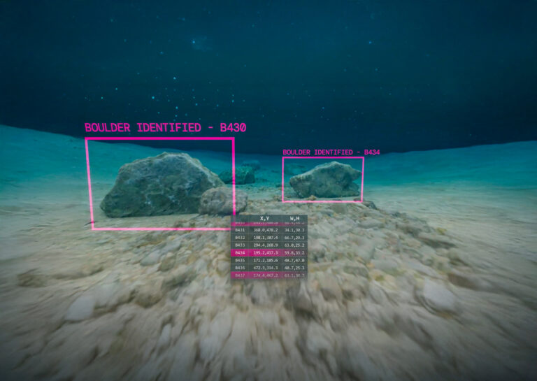
We deliver critical insights about seabed, sub-seabed and environmental conditions. Our carefully selected fleet of DP2 vessels provide flexibility of sensor deployment. Our ASV, Xplorer 18, is a proven offshore survey force multiplier, increasing coverage in limited time frames.
We deliver geophysical survey solutions at all water depths, minimising project risk, improving safety and facilitating the route and project design for offshore developers.
We perform seabed mapping from nearshore and hazardous shallow water to deep water environments, using a range of hydrographic surveying methodologies.
Our geotechnical sampling enhances your understanding of seabed sediments, while geotechnical analysis validates geophysical data, ensuring certainty about physical seabed properties in the surveyed area.
In supporting the planning, consenting, development and environmental protection across new offshore developments, we understand the importance of recording and monitoring the complete environment.